A Better Understanding of Coral Reef Ecosystems

Pelagic predators such as these barracuda, Sphyraena qenie, are part of the coral reef ecosystem in the U.S. Line Islands (NOAA Photo by Kevin Lino).
A team of scientists have embarked from Hawai'i on a three-month survey of coral reef ecosystems at Johnston Atoll, the U.S. Phoenix Islands, the islands of American Samoa, and the U.S. Line Islands in the tropical Pacific Ocean. The overarching objective is to better understand the coral reef ecosystems of these areas, many of which are seldom explored. The research expedition is part of a regular monitoring program, conducted by the Coral Reef Ecosystem Division (CRED), headquartered in Honolulu, Hawai'i. The expedition is supported by NOAA's Coral Reef Conservation Program and involves extensive cooperation among NOAA scientists and research partners, including the University of Hawaii Joint Institute for Marine and Atmospheric Research (JIMAR), the U.S. Fish and Wildlife Service, San Diego State University, and the Papahānaumaokuākea Marine National Monument.

The research expedition will be carried out from February 27 to May 24, 2012 aboard the NOAA ship Hi'ialakai. Under the leadership of Chief Scientists Dr. Jill Zamzow, Dr. Bernardo Vargas-Angél, and Jamison Gove, a diverse team of researchers will be conducting multidisciplinary coral reef ecosystem surveys, assessing the status of fishes, corals, algae, marine invertebrates, and the oceanographic conditions in which these organisms exist. The scientific data collected during the three-month research expedition will enable informed and effective implementation of ecosystem-based management and conservation strategies for coral reef ecosystems, helping to ensure their protection for generations to come.

Monday, March 21, 2011

Wake Island

by Lauren Fuqua
photos by United States Air Force and Ben Richards

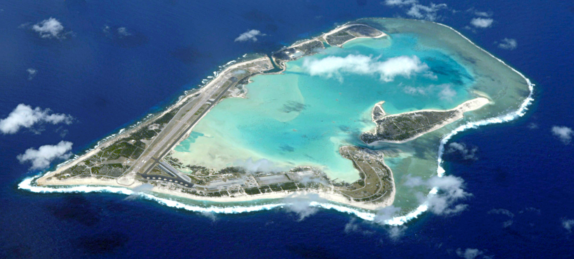
An aerial view of Wake atoll
Wake Atoll (19°N, 166°E) is the northernmost atoll in the Marshal Islands and is currently part of the U.S. Pacific Remote Islands Marine National Manument (PRIMNM).  Wake is oblong in shape (8.5 x 4 km) with three major islands and an internal lagoon, and is an unorganized, unincorporated territory of the U.S.  The U.S. Air Force maintains jurisdiction of Wake and the Missile Defense agency is its principle occupant. Public access to Wake is restricted.

The Battle of Wake Island began simultaneously with the attack on Pearl Harbor and ended on 23 December 1941, with the surrender of the American forces to the Empire of Japan. Of 55 Marine aviation personnel stationed at Wake, 23 were killed and 11 were wounded. During the second assult by the Japanese, on Dec. 23rd, the Wake garrison surrendered to the Japanese. The Japanese captured all men remaining on the island, the majority of whom were civilian contractors employed with Morrison-Knudsen Company. On 5 October 1943, American naval aircraft from Yorktown raided Wake. Two days later, fearing an imminent invasion, Rear Admiral Shigematsu Sakaibara ordered the execution of the 98 captured American civilian workers remaining on the island, kept to perform forced labor. They were taken to the northern end of the island, blindfolded, and executed by machine gun. One of the prisoners (whose name has never been discovered) escaped the massacre, apparently returning to the site to carve the message 98 US PW 5-10-43 on a large coral rock near where the victims had been hastily buried in a mass grave. The unknown American was recaptured, and Sakaibara personally beheaded him with a katana.

POW Rock
The inscription on the rock can still be seen and is a Wake Island landmark. The murdered civilian POWs were reburied after the war in Honolulu's National Memorial Cemetery of the Pacific, commonly known as Punchbowl Crater. The remains of Japanese fortifications during World War are still visible around the islands.

1 comment:

  1. good story but i have no idea how does this relate to the coral problems at wake! GOOD.

    ReplyDelete